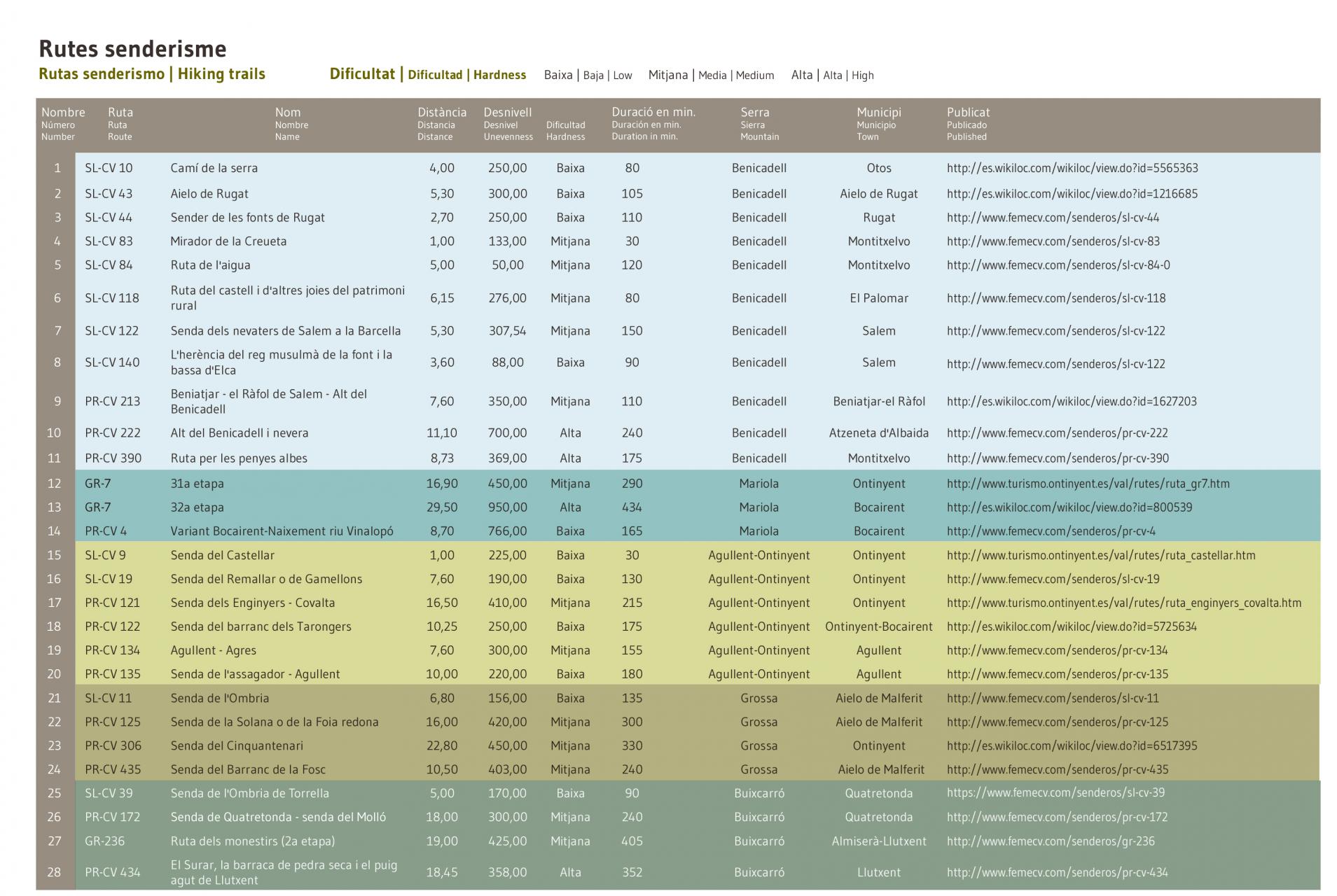
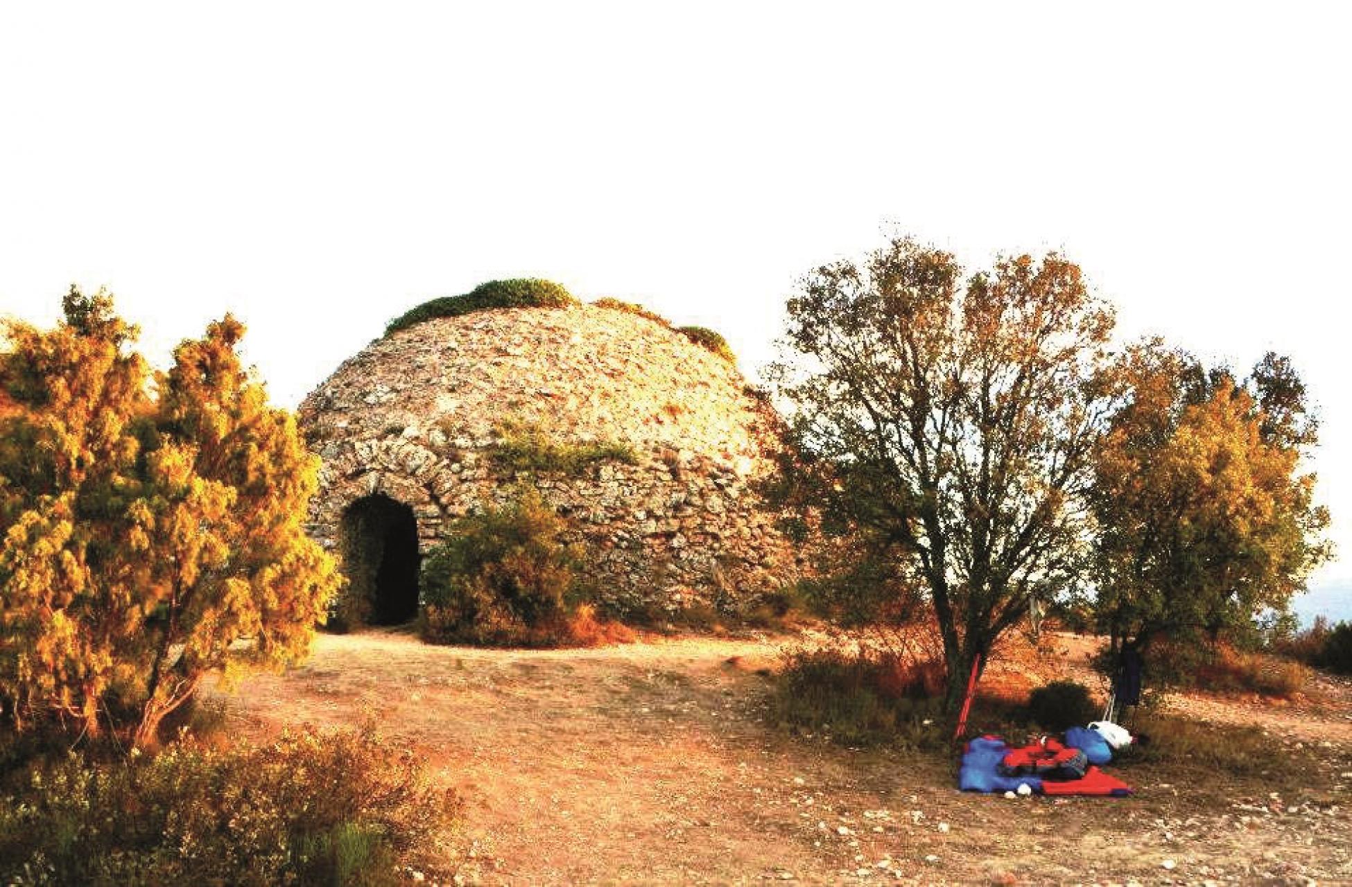
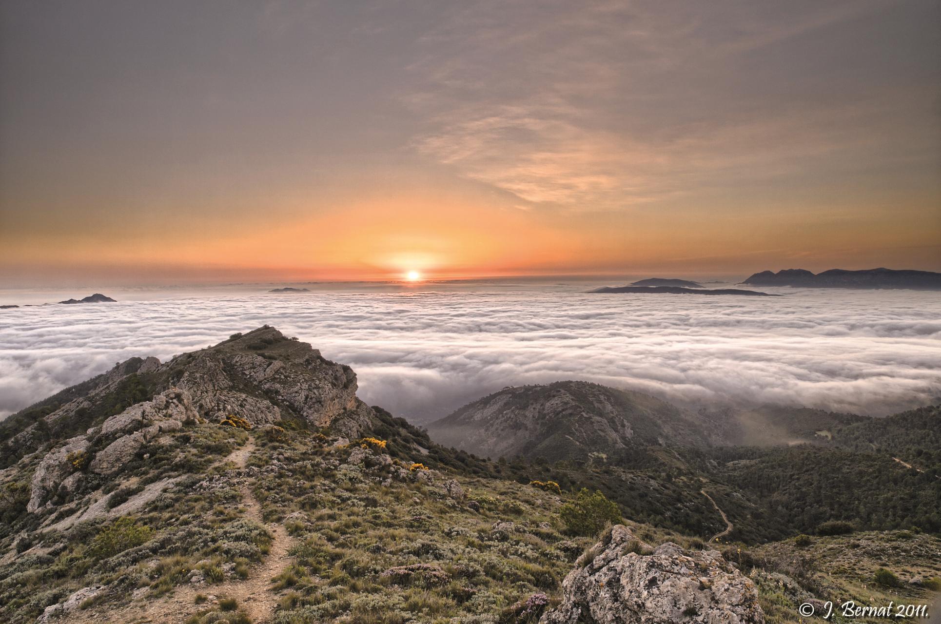
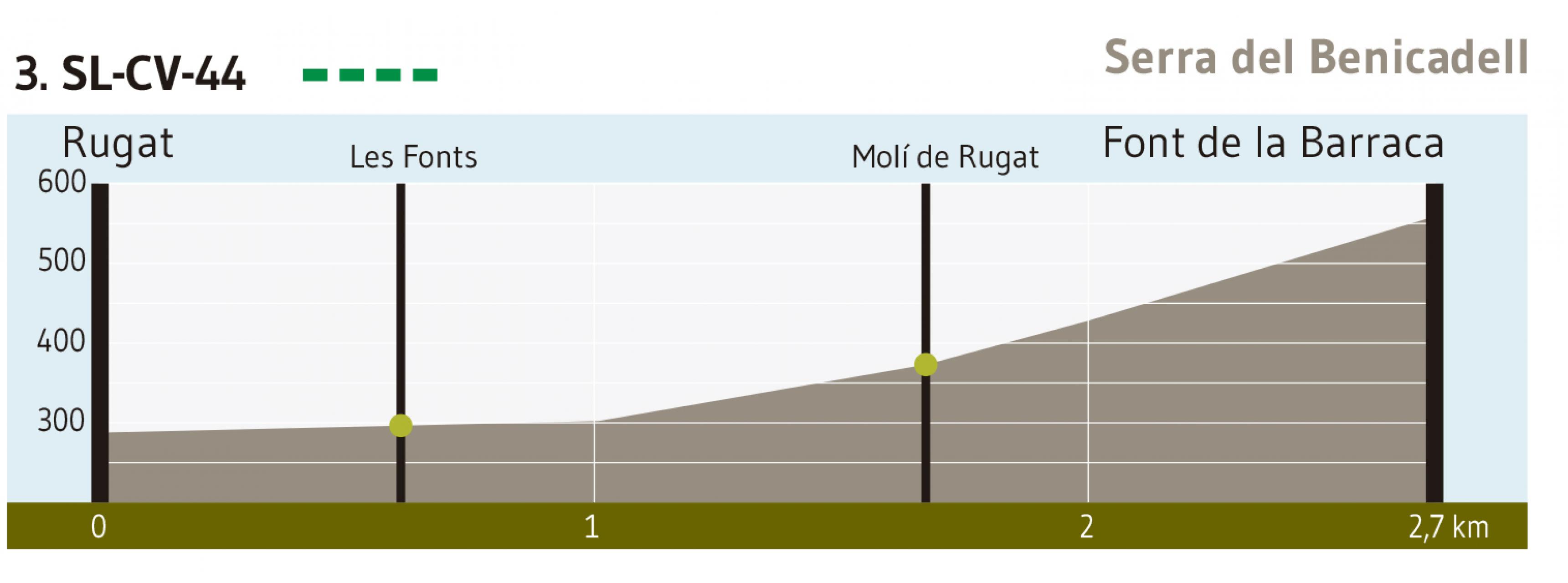
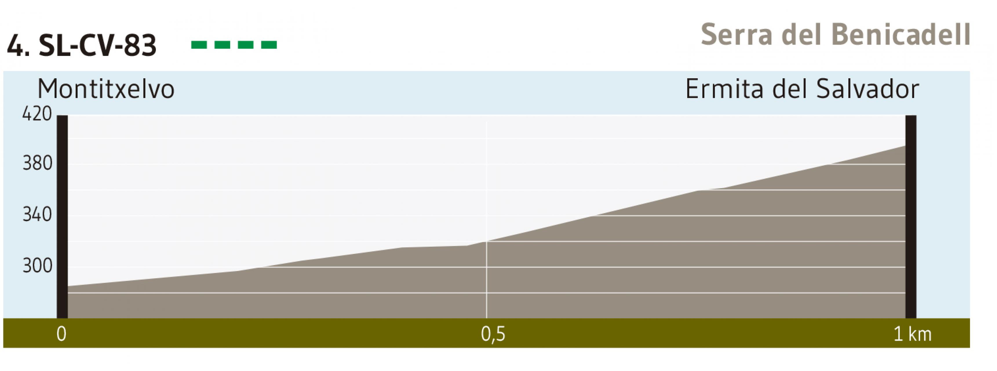
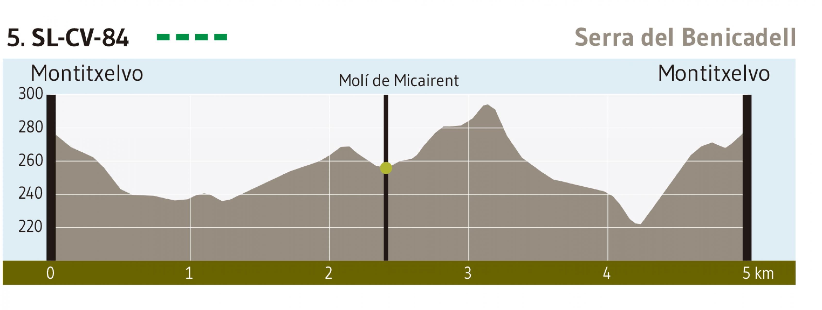
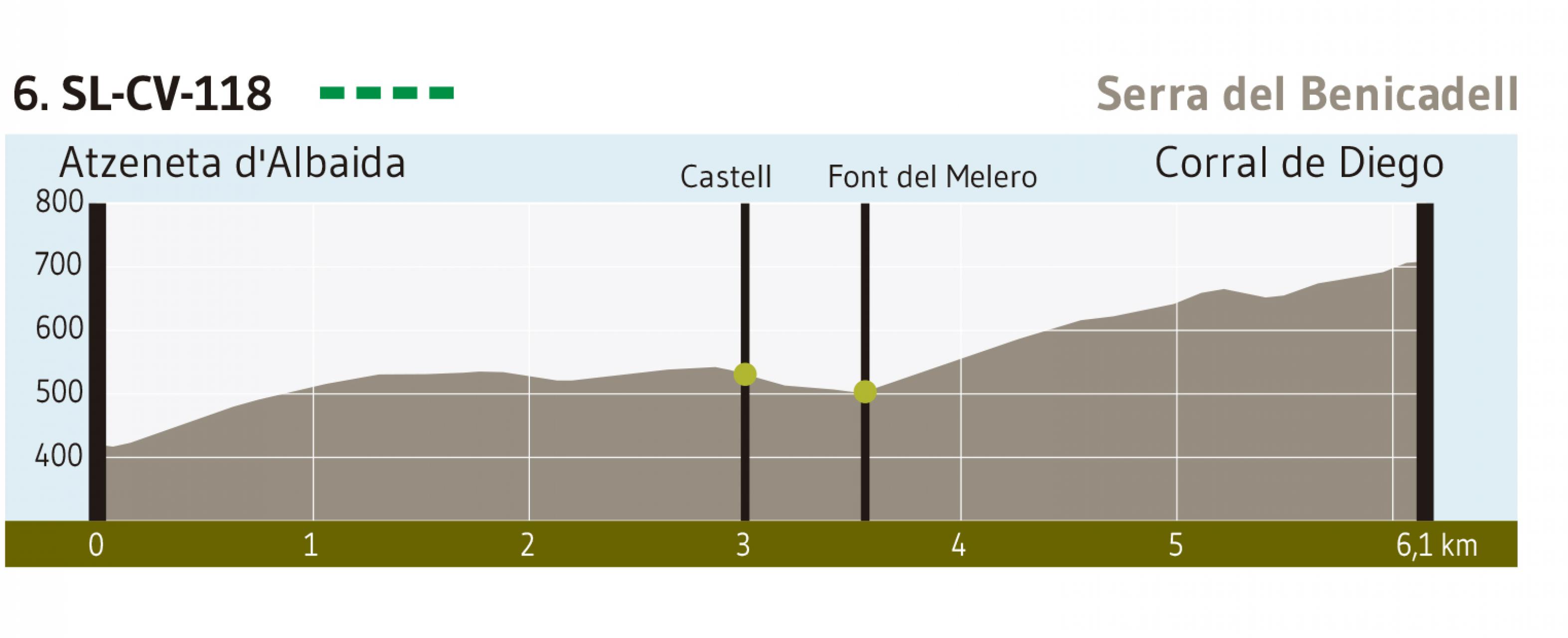
LA VALL D'ALBAIDA
EXPERIENTIAL TOURISM
PROFESSIONAL AREA
DISCOVER US
WHAT WE OFFER
Bar
Bar-Pizzeria
Bar-Pub
Bar-Restaurant
Brewery
Café-Restaurant
Cheese factory
Coffee bar
Coffee-Pastry
Events restaurant
Ice Creams
International
Pub
Restaurant
Take-Away
Tapas
Taverns
Concert halls
Discotheques
Exposition halls
Multipurpose
Pubs
Recreation / Bowling Alley
Tourism promotion
Fashion
Feeding
Flower shop
Free Time
Health & Beauty
Home
Jewelry
New technologies
Services
Stationery and bookshop
Travel agency
Catering
Argentine grillBar
Bar-Pizzeria
Bar-Pub
Bar-Restaurant
Brewery
Café-Restaurant
Cheese factory
Coffee bar
Coffee-Pastry
Events restaurant
Ice Creams
International
Pub
Restaurant
Take-Away
Tapas
Taverns
Leisure Places
CinemasConcert halls
Discotheques
Exposition halls
Multipurpose
Pubs
Recreation / Bowling Alley
Tourism promotion
Shopping
ChildishFashion
Feeding
Flower shop
Free Time
Health & Beauty
Home
Jewelry
New technologies
Services
Stationery and bookshop
Travel agency
PLAN YOUR TRIP